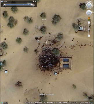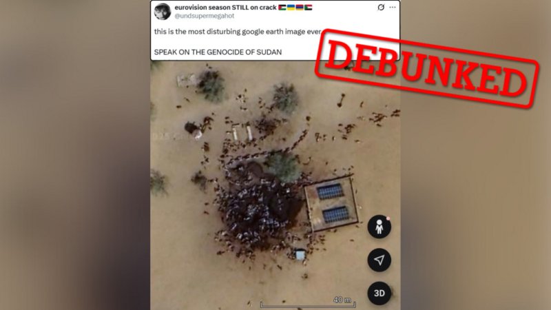
A Google Earth screenshot shared more than 15 million times on X was wrongly described as evidence of mass killings in Sudan after the Rapid Support Forces (RSF) seized El-Fasher on October 26. The image, which shows the town of Kumia roughly 300 km south of El-Fasher, is dated March 16, 2024 and depicts livestock gathered around a watering hole, according to satellite-imagery specialists.
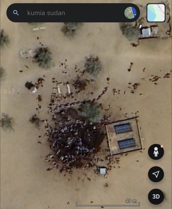
France 24 (Observers) found the image was taken on March 16, 2024 near Kumia and depicts cattle—not mass graves.
Other investigators, including Benjamin Strick of the Centre for Information Resilience, said the dark patch seen in the frame is consistent with water and churned earth, with the small shapes around it matching animals rather than human bodies. Earlier imagery from 2022 shows the same stain at the same spot, further undermining claims that the picture documents recent atrocities.
International alarm over El-Fasher remains well documented: on October 30, the UN denounced “atrocities” following the city’s capture, and the International Criminal Court warned they may constitute war crimes and crimes against humanity.
But analysts stress that this particular viral screenshot is unrelated to those events and illustrates how misread satellite scenes can inflame an already fraught information environment.